14th Newsletter – December 2019


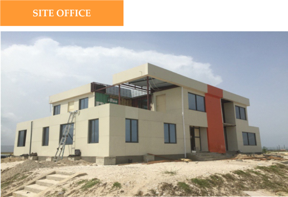

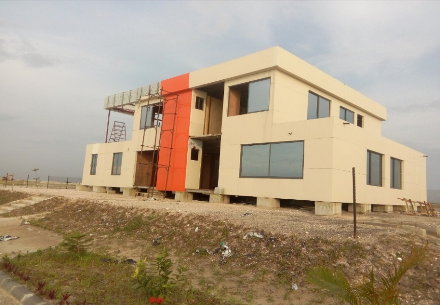
Our office is substantially completed. We look forward to moving in the New Year.
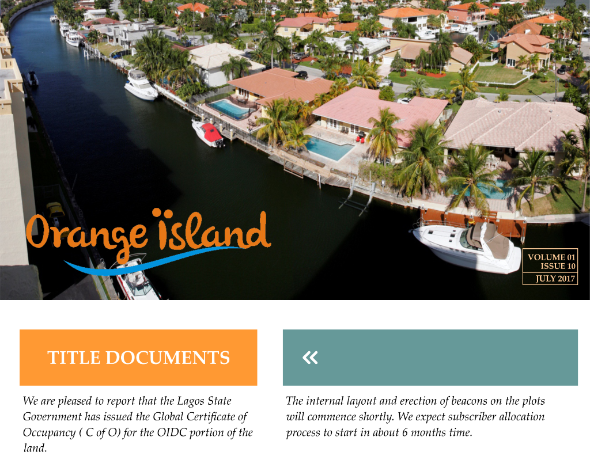
Title documents
We are working with the Lagos State Government to secure the global Certificate of Occupancy for the OIDC portion of the Island. Once concluded, we will begin the process of issuing deeds of sublease to our paid up subscribers.
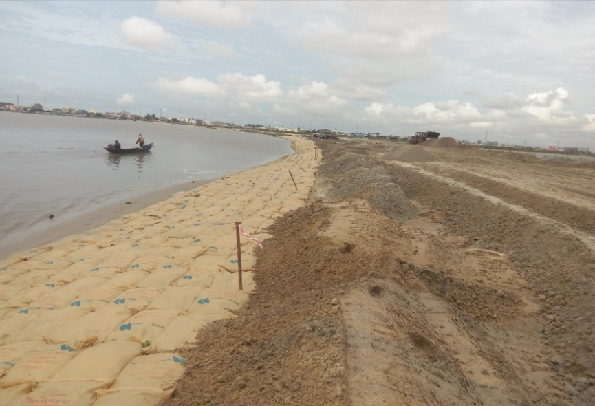
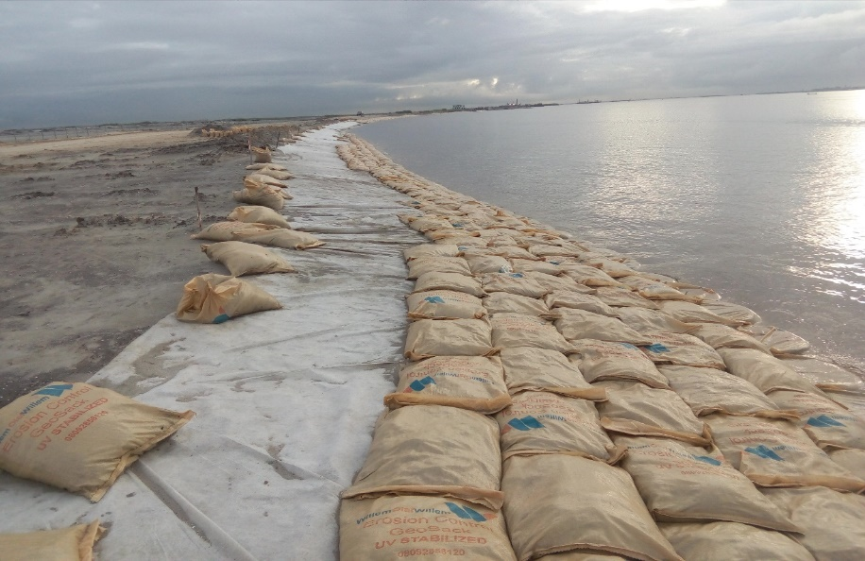
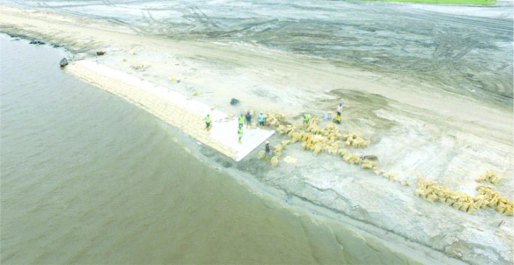
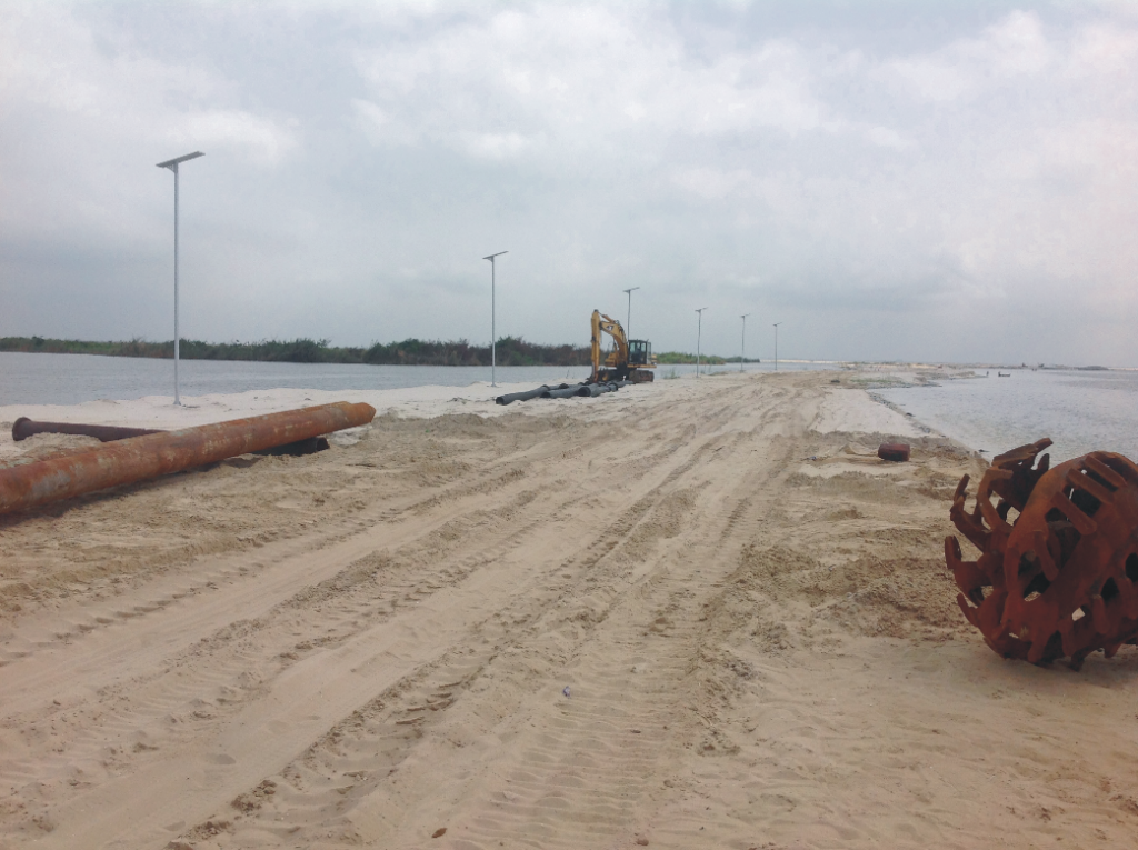
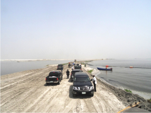
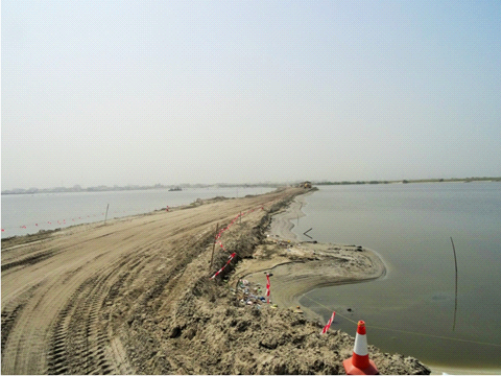
We have achieved good progress on the shore protection work on the access road. This has proved its importance especially during the rainy season, by protecting the access road from being washed away.
The 4th Quarter Impact Mitigation Monitoring Report has been completed and submitted to the Federal Ministry of the Environment. The next phase of EIA reporting has commenced with EcoPro being engaged to carry out the analysis for the Infrastructure and Access Road.
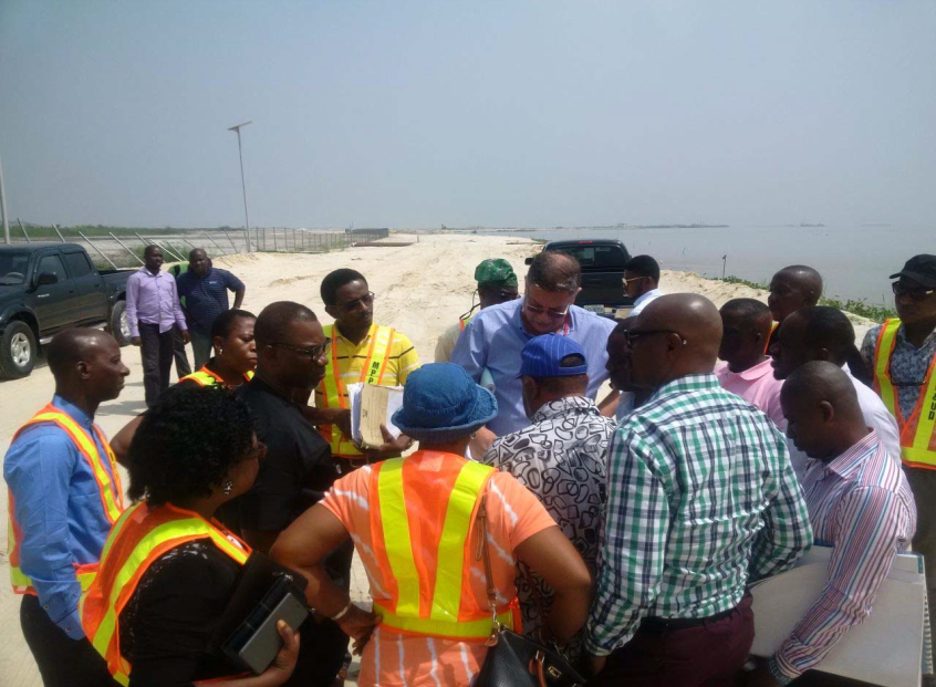
A delegation of the Federal Ministry of Environment, Lagos State Ministry of Environment and Eti-Osa Local Government has carried out their half-yearly inspection for the monitoring of environmental mitigations. The mission included meeting with the Project’s EIA Consultant and OIDC Project Team as well as a detailed site visit. The delegation confirmed compliance with all regulations.
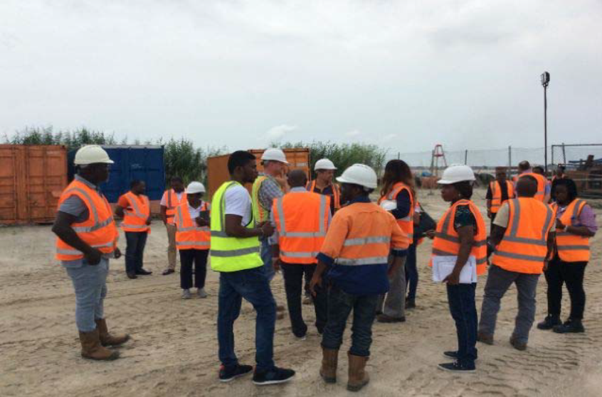
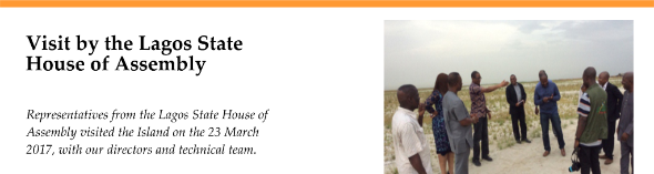
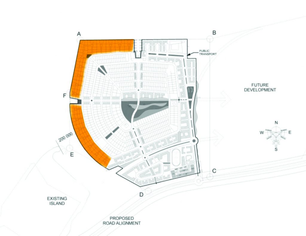
Representatives from Lagos State Ministry of Physical Planning & Urban Development and Ministry of Works visited the Island and its access road, to inspect the road’s alignment with regard to the proposed Regional Road and Lagoon Road which are arterial roads scheduled to start in 2017.
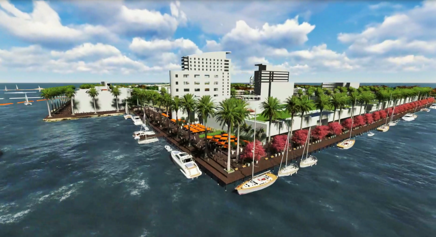
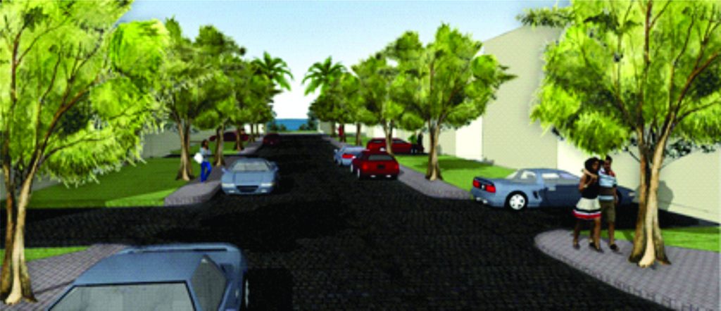
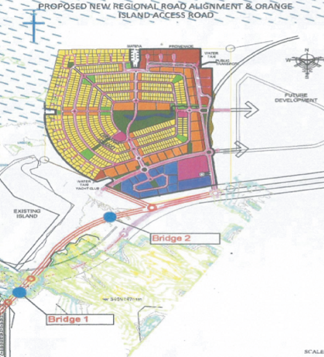
The Promenade The marina will be a focal point of the development and the node will be approached from a boulevard of mixed-use developments, terminating in a village square. Surrounding the square, a hotel / conference facility with retail and a promenade to the marina is proposed. A ferry terminal will be accommodated that will allow local residents to commute and ease vehicular congestion.

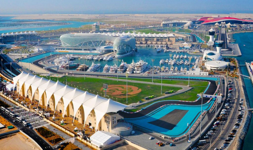
Yas Island (Arabic: جزيرة ياس) is a man-made island in Abu Dhabi, UAE. It is the second largest island in the world. The island’s development project was initiated in 2006 by Abu Dhabi-based Aldar Properties (master developer), with the aim of turning the island into a multi-purpose leisure, shopping and entertainment centre at an estimated total cost of over $40 billion. This investment was planned as a multi-staged project to unfold in phases until 2018, with project stakeholders foreseeing the possibility of extending development by adding new venues and upgrading existing facilities. It occupies a total land area of 2,500 ha (25 km2), of which 1,700 ha will be claimed for development. Yas Island holds the Yas Marina Circuit, which has hosted the Formula One Etihad Airways Abu Dhabi Grand Prix since 2009.
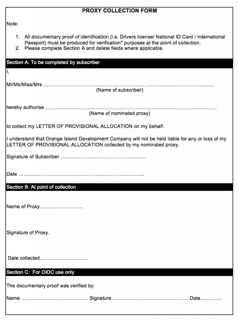
Please note that in the event that you are unable to comply with your payment plan, OIDC will be constrained to refund monies paid to the date of default less administrative fees as specified under Clause 11.3.1 of the Contract of Sale.
If you are interested in visiting the Island, please call our office to book an appointment and collect an access tag. During the holidays, please collect tag from the security office at the start of the access road. You will need to register so please bring along a photo ID.
Our office will close for Christmas on 16 December 2016 and will reopen on 9 January 2017.
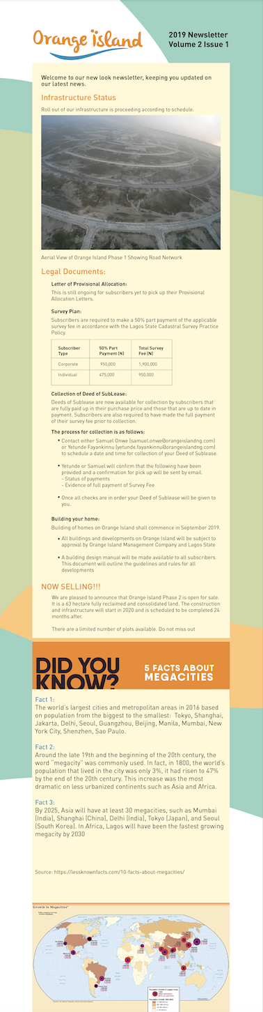
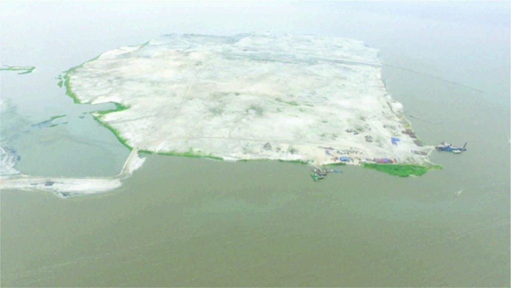
We are delighted to announce the completion of the reclamation of Orange Island ahead of schedule. We continue to work on the bulk earthworks to bring parts of the Island to required levels.
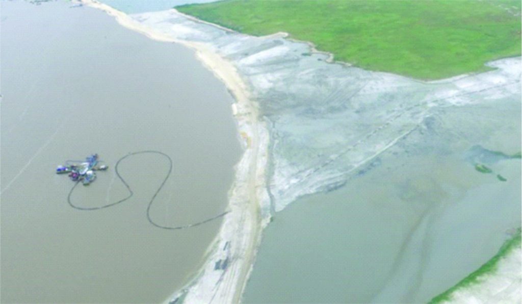
Bulk earthwork of the access road continues. The road is currently being shored up to protect it from wave action in the lagoon.
The neighbouring island, Lekki Foreshore has been expanded by a private contractor and abuts unto the access road.
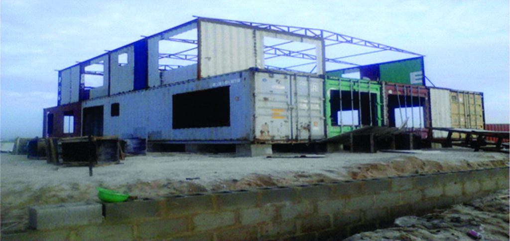
Our new offices are under construction on site. The office is being built out of shipping containers. Each container measures 8 feet wide by 40 feet long by 9 feet tall. The containers make ideal building materials as they have an infinite life span when stationary and properly maintained. Environmentalists have embraced this, applauding the recycling inherent in these types of offices.
The new offices will be ready in the last quarter of the year. We can’t wait to move to the island!
Our website is up and running. Check us out at www.orangeislandng.com
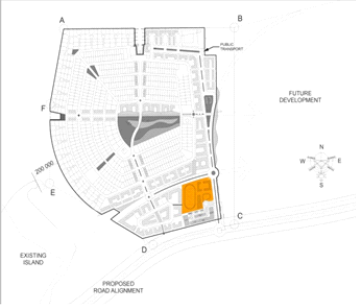
The Residential Enclave
One of the main features of the island are the residential enclaves dotted around the island. They are the unique clusters designed around cul de sacs along the perimeter of the island.
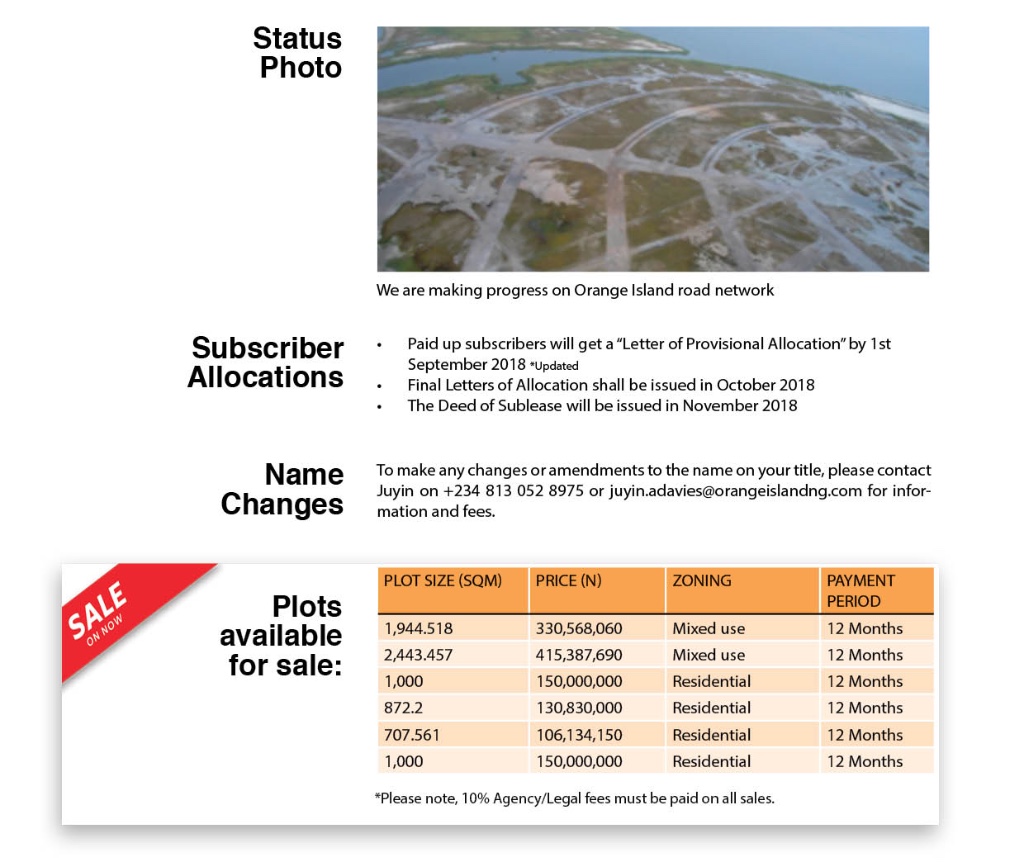
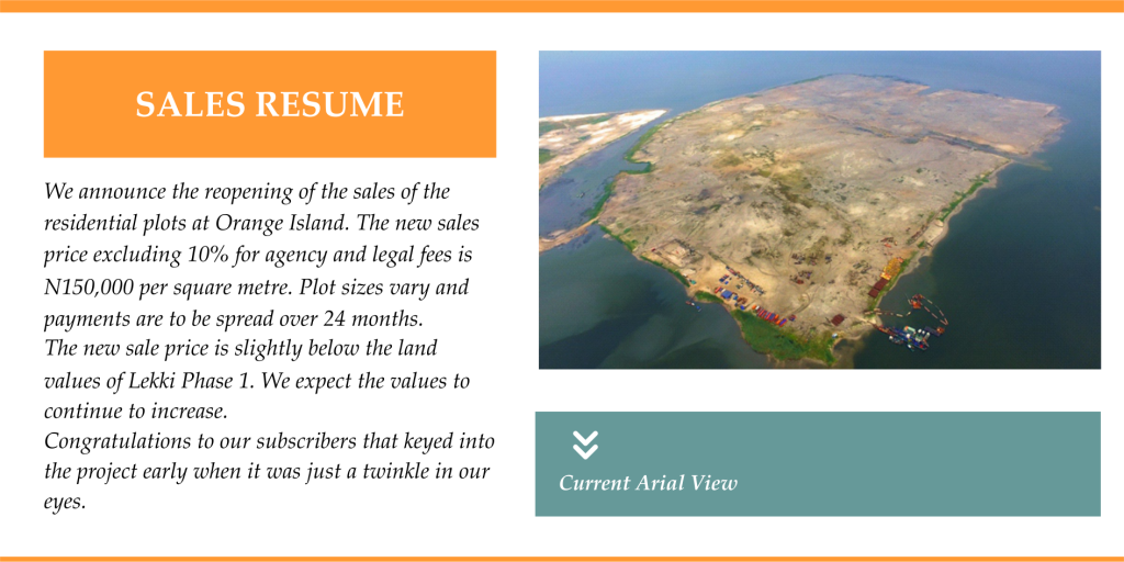
The sale of plots remains on hold, however, the reservation list is still open for those interested in purchasing plots.
To be added to the reservation list for plots, please contact Daniel Etiefe on his mobile +2348085054212 or at daniel.etiefe@orangeislandng.com. Alternatively visit our website: www.orangeislandng.com
For proper account reconciliation, please forward all payment evidence (such as tellers, cheques and online transfers) to the marketing team via email
Emails: daniel.etiefe@orangeislandng.com or samuel.onwe@orangeislandng.com
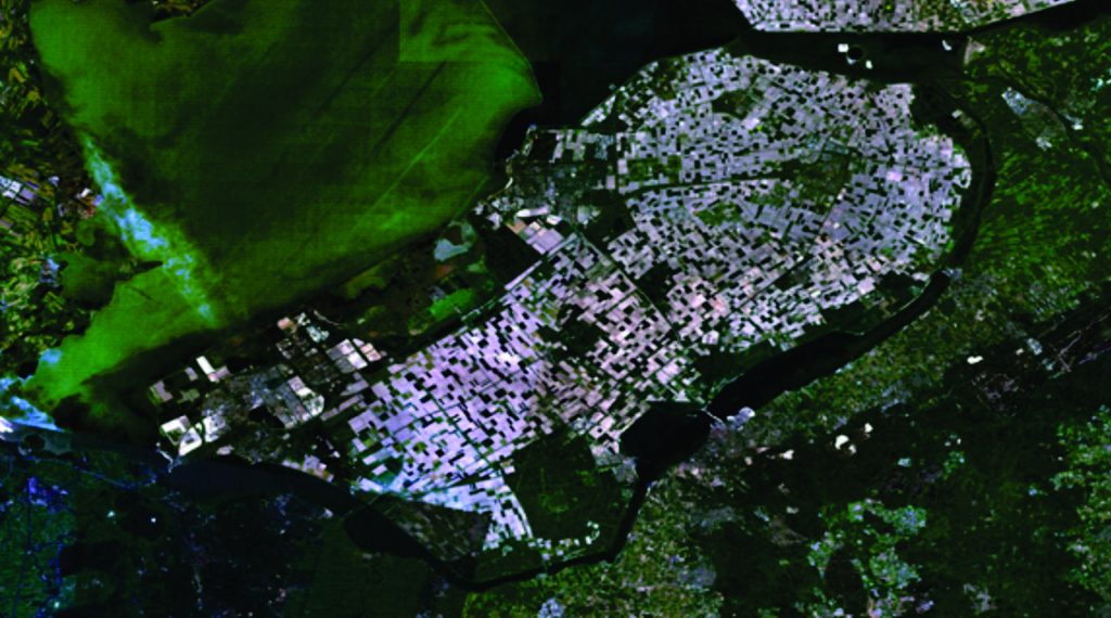
The Flevopolder is a region of reclaimed land, in Flevoland, Netherlands. It is the largest Island formed by reclaimed land in the world with a total land surface of 97,000 hectares, completely surrounded by bordering lakes, the Veluwemeer, Ketelmeer, and Gooimeer.
For more than 2,000 years, the Dutch have been striving to hold back as well as reclaim land. The Frisians, the first settlers in the Netherlands, started building dikes to safeguard their land from the North Sea. In 1287, the dikes failed, causing a flood in the country and formation of the new bay Zuiderzee over the farmland. The Dutch worked consistently for a few centuries to slowly push the water out of Zuiderzee and built dikes and created polders, pieces of reclaimed land. After building the dikes, the water was pumped out to keep the land dry.
Flevoland is separated by a dike and is kept dry by operating diesel and electric pumps.
In 1969, the Island was finished, as part of the Zuiderzee Works. Flevoland consists of two polders Eastern Flevoland and Southern Flevoland. The eastern part was drained in 1955 and the southern part in 1968.
125 hectares of land has been reclaimed to date. Only 20% left to go!
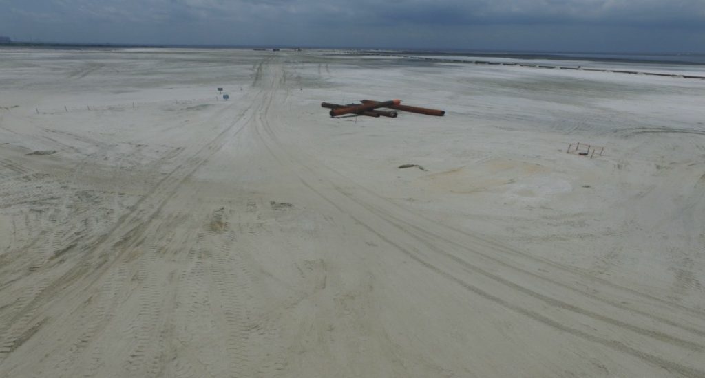
The access road links Orange Island (at its southern side) to Itedo Waterfront. The new road has views of the lagoon on both sides. Reclamation along the alignment of the road and stock piling of sand has reached an advanced stage. This is to complete the filling of the road up to the full width and required levels. In addition, 10 temporary solar power electrical poles have been erected along the road for security. Bridges are to be built in 2 places along the road to provide access for small watercraft.
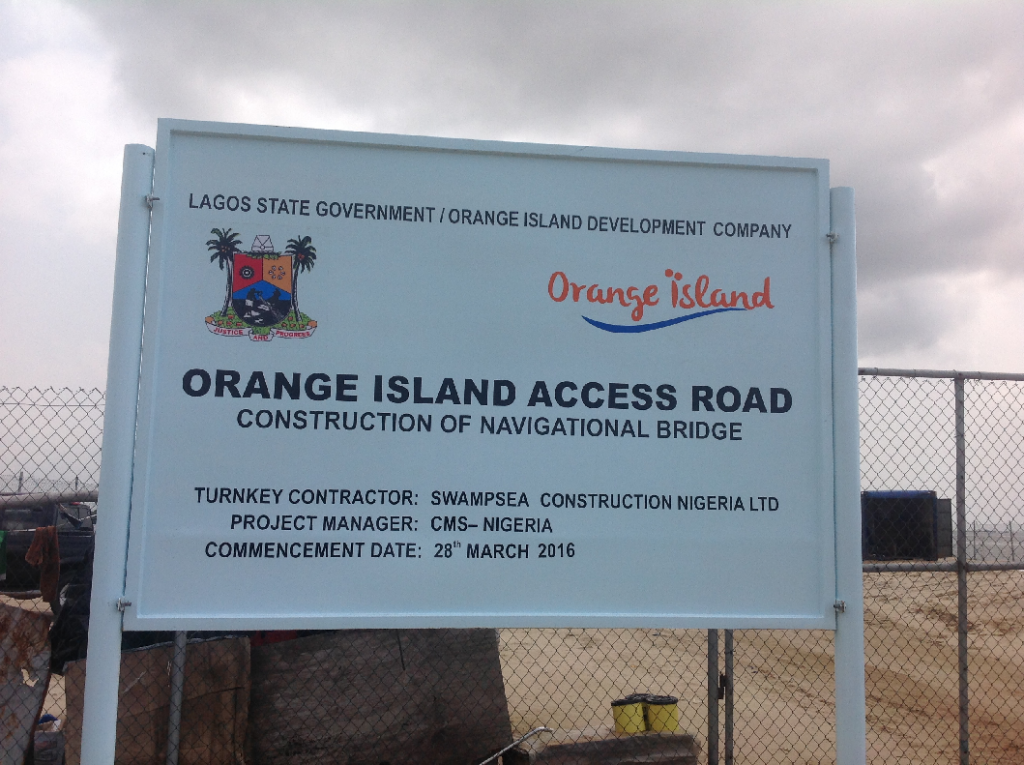
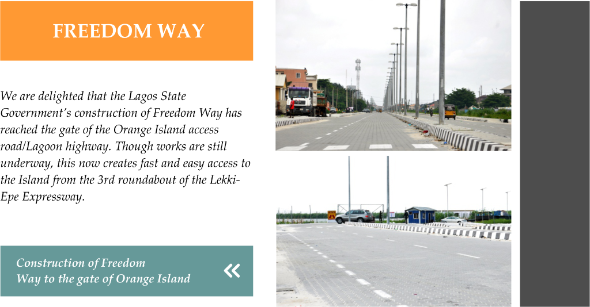
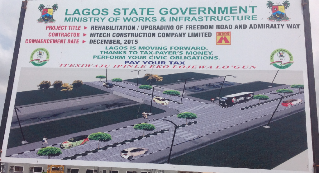
The road will eventually become one side of the Lagoon Highway, which according to the Lekki Master will run along the Lekki Peninsula waterfront from Freedom Way to Epe. The Lagos State Government has awarded the contract for the construction of Freedom Way which will create a fast access to the island from the 3rd roundabout of the Lekki Epe Expressway.
The 3rd Quarter Impact Mitigation Monitoring Report has been completed and submitted to the Federal Ministry of the Environment. The next phase of EIA reporting has commenced with EcoPro being engaged to carry out the analysis for the Infrastructure and Access Road.
The Commercial Strip
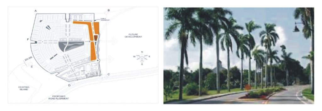
The main boulevard will house mixed-use developments that will include shops, offices and residential uses. It will provide access to a variety of land-uses including residential and public facilities. This positioning of this central spine is critical for the natural link with the future phase.
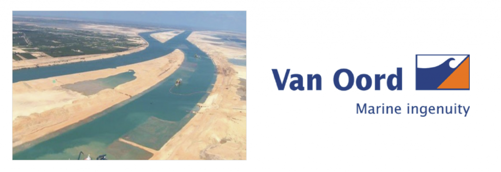
The New Suez CanalThe New Suez Canal is one of the world’s largest dredging projects at present. The plan is to expand the capacity of the existing Canal and will add a new 35-kilometre-long (22 mi) second shipping lane to the existing 164-kilometre-long (102 mi) canal. It also includes the deepening and expansion of a 37-kilometre-long (23 mi) section of the existing canal.
The enlarged capacity allows ships to sail in both directions at the same time over much of the canal’s length. Beforehand, much of the canal was only one shipping lane wide, with limited wider basins for passing. This is expected to decrease waiting time from 11 hours to 3 hours for most ships, and to increase the capacity of the Suez Canal from 49 to 97 ships a day. We celebrate with our dredging contractors Van Oord, part of the consortium that participated in the project.
Look out for our new website which will be up and running from 1 May.
Onome is away on study leave. Please contact our new marketing manager Daniel Etiefe on 08085054212, 08067373155, 07046478044 or by email on daniel.etiefe@orangeislandng.com OR
Samuel Onwe Samuel.onwe@orangeislandng.com


We are pleased to announce that the reclamation of the access road has been completed and visitors can now drive directly from the end of Freedom Road to the Island. The Island was linked on 8 December 2015. The new road has views of the lagoon on both sides. Even though the Island has been linked, it is still work in progress. Sand filling will continue in order to attain the right width and levels.
Reclamation of the Island is still progressing with 102 hectares dredged to date.
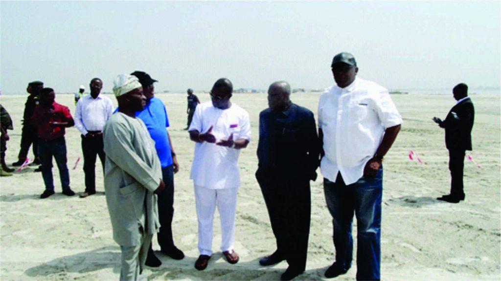
The Chairman of Orange Island Development Company, Alhaji Musiliu Smith CFR visited the island on 9 December, accompanied by four of our non executive directors, Alhaji Waheed O. Kassim, George Nwachukwu, Chiedu Nweke and Theodore Omalu to inspect the new access road.
Orange Island continues to be fully compliant with regulatory authorities. In November 2015, the second quarter of the Impact Mitigation Monitoring report was completed and submitted to Federal Ministry of Environment as well as Lagos State Ministry of Environment. This is an important regulatory milestone for the project.
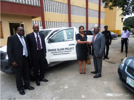
Orange Island Development Company recently donated a Toyota Hilux to the Ministry of Waterfront Infrastructure Development. The official presentation of the vehicle was made to the Commissioner, Engr. Ade Akinsanya and permanent secretary Nurudeen M. Salami by the Managing Director, Yinka Ogunsulire and Non Executive Director Lookman Durosinmi Etti.
The Educational Hub
The schools site is located to the south east of the island close to main access road. It measures about 5.3 hectares and is designed to house a number of educational institutions around common playing fields and sporting amenities.
If you are interested in visiting the Island, please call our office to book an appointment and collect an access tag. During the holidays, please collect tag from the jetty office at the start of the access road. You will need to register so please bring along a photo ID.
Our office will close for Christmas on 18 December 2015 and will reopen on 4 January 2016.
Recent Comments